Backcountry adventure and cuisine for aspiring hiker trash
Pictured Rocks Lakeshore Trail Pt. 1
One of the best sections of the North Country Trail
I have just returned after a 2-day drive back from the Upper Peninsula of Michigan, and one of the best hikes I’ve ever done- the 43 mile Lakeshore Trail segment of the North Country National Scenic Trail that passes through Pictured Rocks National Lakeshore. It was worth every bit of the the 18 hour drive from Alabama.
I happened to hit this one during a period of splendid weather, generally sunny with highs around 70 and lows around 50. And with only light bug pressure.
True to form though, I almost bungled the whole thing.
I arrived in Munising Michigan a week ago on a Saturday evening. Check in at the Sunset Bay Motel was a breeze. I killed some time in their backyard gazing out over Lake Superior while I awaited dinner time.


Munising is a small town of 2,300 on the south shore of Munising Bay, aka the South Bay of Grand Island Harbor. As a town that is heavily reliant on tourism, it has a disproportionate number of quality places to eat. I chose Taco Primo.

Considering where I was, it was only appropriate that I order the local specialty.

After dinner I retired back to my motel room, where I still had a lot to do, mainly repackaging my meals. This resulted in a big box full of empty packaging and wrappers. Hopefully housekeeping was used to this sort of thing from backpackers. I then went through the final packing of my pack. This was easily the lightest my pack has ever weighed (view my LighterPack HERE) at a mere 7.1 lbs., which was the source of much envy on the trail.
Satisfied with my preparation, I set my alarm for 6 AM and went to sleep.
I was up, caffeinated, showered, fed and at the Munising Visitor Center to await my 8:00 shuttle by 7:15. This is where things briefly went very bad. At 7:50 I suddenly realized that my pickup was actually supposed to be at the Munising FALLS Visitor Center. In a panic, I loaded up the car, found the correct address, plugged it in to my GPS and hauled ass….only to encounter a ROAD CLOSED sign! I was unable to find a different route in time, so in desperation I took off for the Grand Sable Visitor Center (where my shuttle was supposed to take me to). I reasoned/hoped that I could find a shuttle back to my car when I completed my hike.
I arrived at Grand Sable at 9:20. The ranger-type person on duty showed me where to park and offered encouraging thoughts about my chances of shuttling back.

The trail began off the backpacker parking lot across the street.


I was a bit bummed to see the hike begin through an overgrown grassy meadow that looked like tick heaven, with the trail easy to feel but difficult to see at times.

Before long though the trail dipped into the woods, and the trail was easy to follow. Almost immediately I saw the densest patch of Canada Lilies ever. I guess they were happy to be so close to Canada.

After a little over a half mile, you hit a road (H58) and turn left for a little road walking. The road borders the Grand Sable Sand Dunes on the right and Grand Sable Lake on the left.


Right about the time you’re starting to wonder if you missed the trail cutoff, signage saves you.


The trail then briefly darts in and out of the woods around the edge of the lake before committing fully to the forest.

I found this little guy in the woods.


I made great time through the largely deciduous forest, as the terrain was very level. Eventually I was aware that the wooded back side of large sand dunes were off to my right.

Just before reaching the Masse Homestead Campsite roughly 5 miles into the day, I kicked up 2 does with vivid burnt orange summer coats that really stood out among the greenery.
I met some folks at the Masse Campsite that had packed in a whole heap a shizzle, which they were now taking out via Log Slide nearly a mile away. Using a wheelbarrow. Multiple trips too. Oh, they also had a cooler that I am sure still had some beers in it. But they didn’t offer. This was to be a recurring theme on this trip.

I popped out of the woods at about 5.8 miles at Log Slide, a STEEP and LONG sand dune. Supposedly back in the days of logging, this steep sand dune was used to slide the logs down into Lake Superior for shipping.

It’s considered a challenge to “walk” all the way down the slide to the lake and then to laboriously climb your way back up. It’s apparently really hard. I was told that occasionally a city cetacean gives up and has to be rescued by water.


While the Lakeshore Trail is generally one of the most level footpaths you’ll ever have the pleasure to hike, there ARE some ups and downs. Just when you get complacent, it goes all AT on your ass.


Just before reaching my campsite I had to cross a sketchy-looking bridge. It turns out that many of the footbridges up here look like this. I guess the winter weather doesn’t treat them too kindly.

At around 1:30 I wandered into my campsite- Au Sable East- set back in the woods a short distance from the lake. I decided to go fill up on water before setting up camp. Lake Superior was the water source for this campsite.
So you’re probably thinking, EWWWW, lake water, how gross. Here in Alabama lake water is only one short step above a cow tank. Well, think again. Lake Superior is absolutely crystal clear.


You do of course filter the water.
Back in camp I selected campsite #1 because that’s the king’s campsite. And I did a MUCH better job of setting up my Tarptent Aeon than I did on my last hike. I think it helped reading the set-up instructions this time.

The National Park Service has wisely installed bear-proof food storage units at all of the campsites on this trail. They haven’t had trouble with bears and aim to keep it that way.

I settled in for a big afternoon nap. I mean, I had a ton of time to kill, I had to do something.
Eventually over the next 4-5 hours the campsite filled up completely, and it was possibly the best social group camp ever. There were 7-8 students from Michigan Tech, a young female couple, and a pair of ladies a little older than me. Each and every one was very friendly. We ended up building a campfire and having some excellent fellowship over dinner that lasted until hiker midnight.
Most of them were Yoopers- denizens of the UP. Yoopers are a lot like Canadians, and they finish a lot of their sentences with “Eh?”

The Yoopers enlightened me as to what they do during the long winter- “We drink beer, eh?” It should be noted that ice-fishing, cross country skiing and snowmobiling are also popular. Snowmobiles actually are allowed on paved roads in winter, but they have lower speed limits.
They taught me that the dreaded stable flies that plague the area when the winds are southerly don’t bite. No, they CUT you so you bleed. These are the OG’s of the fly world. Oh, once you bleed they then suck your blood.
I also learned about what happens if you’re driving and hit a moose- “You don’t hit moose, moose hit you!” These are all good things to know as a Southerner if you venture into the far north woods.


Day 1: 7.1 miles.
I slept kinda late since I didn’t have to make many miles on Day 2. I took the time to cook a hot breakfast (Peak Refuel Breakfast Skillet, review coming soon). I chatted a bit longer with Monique and Susan, and finally took off around 9:30. Several tenths of a mile later I reached the first highlight of the day.

Au Sable Light Station was built in 1873 and includes a lighthouse as well as quarters for the keeper and assistant. The light itself was originally fueled by lard oil and then by kerosene before becoming automated in the 1950’s. There are tours, but apparently I arrived too early.
There were quite a few tasty treats growing nearby as well as some late season wildflowers.


The trail follows the sidewalk around the lake side of the light station. And behind the light station, there is something amazing.

Wait, you say, I only see two things- a porta potty and a bear-proof garbage can. Aye, ’tis true, and a sweet bounty they are. But the TRIfecta only becomes apparent once you’re in the porta potty….when you discover that it is stocked with actual toilet paper!

This was certainly a better option than the open-to-the-whole-wide-world privy back at my previous campsite.
About a half mile later (maybe less) the trail turned into a long beach walk.


Eventually though you start to wonder if you missed the spot where the trail cut back into the woods. The answer becomes readily apparent when you near the end of the beach.

After a very short climb back into the woods the trail follows a gravel road to Hurricane River Campground, one of the places for drive-in campers.


There were a few groups of people with pop-up campers, all of whom had coolers and none of whom offered the poor weary dehydrated hiker a beer. The cruelty was breaking my spirit.
The trail dove back into the woods just beyond a picnic table at the far edge of the campground. I believe that there was signage directing me that way. More beach soon appeared.

Chipmunks periodically exploded from holes right at my feet and scurried off to a safe vantage point from where they cursed me with their chirps and whistles. I managed to catch a pic of this one directing foul rodent verbiage at me from his refuge.

I started seeing a lot of bunchberry (Cornus canadensis) plants full of red berries. This plant is in the same genus as our dogwood tree.

The trail then followed the edge of Twelvemile Beach, unfortunately often through some heavy sand at the edge of the woods that slowed my pace considerably.

The Twelvemile Beach Campground was huge, seemingly a half mile stretch of tidy campsites in the trees near the lake, most of which were occupied by SOBs with coolers who once again were stingy with the beer that I KNOW they had. C’mon, these are Michiganders, I know they’re not teetotalers! Two separate older gentlemen stopped me for some friendly conversation. Neither offered up a cold beverage though, and it was beneath my dignity to whimper an “un cerveza, por favor” at them. I was resigned to my beerless fate.
I took advantage of a nice empty campsite at the edge of the dunes under some pines to take a snack and water break.

While I snacked on some jerky and Babybel cheese, I watched a large sailboat cruise by.

After hiking another mile or mile and a half I crossed into a special place.

The 11,740 acre Beaver Basin Wilderness was signed into law by President Obama in 2009 (Thanks, Obama!). The wilderness encompasses a 13 mile stretch of shoreline and extends up to 3.5 miles deep from shore. Notable wildlife that it protects include native coaster brook trout, timber wolf, pine marten, black bear, fisher, bald eagles and peregrine falcons. It also features several lakes, including the 762 acre Beaver Lake, as well as an old growth cedar swamp. Eminently worth protecting.
You enter the wilderness after crossing Sevenmile Creek.

You would think that it would be 5 miles between Twelvemile Campground and Sevenmile Creek. You would be wrong. More like half that. Probably the people who named those places had beer, large quantities of it, in their systems when they named things. Unlike myself. Not that I’m bitter.
It wasn’t long before I wandered into Sevenmile Campground. I met the Foxes, a family of four that I would leapfrog with during the remainder of the week. Willow and Emma were already there as well. We had another good group campfire, and I had a tasty hamburger skillet dinner (review soon come). Soon it was hiker midnight and we were all asleep.
Day 2: 7.3 miles.
I wasn’t really feeling it the next morning. I slept late and didn’t cook breakfast, merely eating a Snickers while I quickly broke camp.
The first few miles of the day were lovely flat trail, part of which may have been on an old roadbed.

Several miles into the morning I passed the infamous abandoned car.

The miles flew by quickly. At around 3.5 miles I reached the 0.5 mile side trail to Trappers Lake and its campsite. I skipped this side trip and continued on.
Shortly thereafter I returned to the sandy edge of a beach, possibly the continuation of Twelvemile Beach.


A half mile later I reached the Pine Bluff campsite, which I decided to visit since I needed to offload some cargo in the privy. There was a maze of trails that seemed to connect all of the individual campsites, and it took me a few minutes to locate the privy. When I finally did, I was sorely disappointed.

The reason the privy is hard to see in the above photo is because it has no friggin’ walls! These people are uncivilized barbarians. You are apparently expected to do your business in full view of multiple campsites. Nobody wants to see naked man butt in the wilderness.
Luckily for me nobody was there at the time.

I left with a feeling of shame lol.
The next mile and a half weaved around the edge of a beach.

I then reached the tangled mess of the Beaver Creek outlet. The trail was pretty sloppy through here, and mosquitos made a rare appearance. I quickly DEET’d them into Bolivia.


After crossing, the trail turned left and followed Beaver Creek upstream for a short distance. The creek was crystal clear, with an entirely sandy bottom. I suspect there are some trout in the deeper holes.

Having made good time, I decided to take the 0.5 mile side trail up to Beaver Lake. The lake itself was pretty enough, but the main attraction was its complete seclusion.

There was a nice sandbar that curled around near the shoreline to the west. I walked along it until I discovered that this was apparently where everyone walked their dog. Land mines everywhere.
On the way back to the Lakeshore Trail I found one of my forest buddies, Mr. Bufo.

In another mile and a half or so, I reached The Coves campsite, my home for the evening. It was tucked a short ways back from a nice beach. I went down to enjoy it before setting up camp, and ended up taking a LONG nap in the sun. It was glorious. When I woke up, I filled my water bottles and bladder, which involved having to wade out into the surf of Lake Superior. I should’ve just gone ahead and taken a swim while I was at it. Goodness knows a bath would’ve done me good at this point.

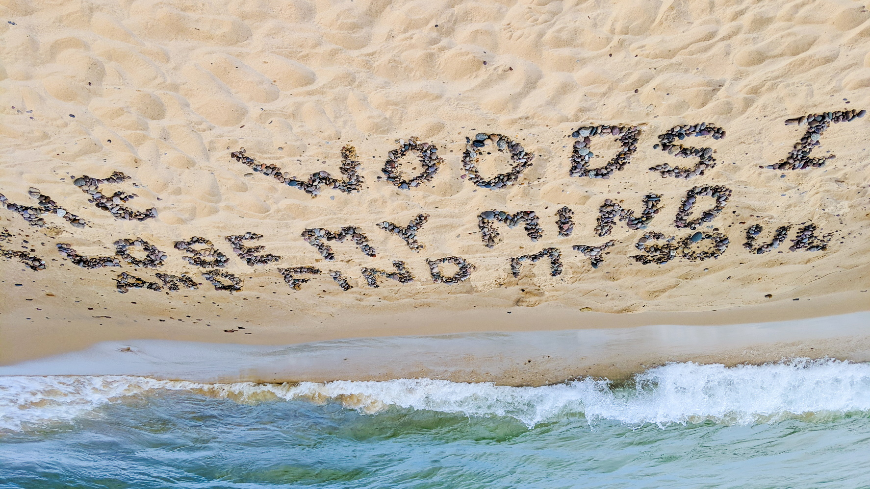
approaching me with a beer in hand. Savages.
Familiar faces in camp included the Foxes and Willow and Emma. However, we didn’t do the campfire thing this time. Everyone cooked an early dinner and went to bed before dark. I was personally excited though, because I knew the really good stuff started tomorrow.
Day 3: 8.3 miles.
Recent Comments